Roam N Rest Kenya
Roam N Rest Kenya
Roam N Rest Kenya

Tana River County

Tana River County lies inland from Kenya’s northern coastline and is named after the country’s longest river. Covering approximately 35,375 square kilometres, it is one of Kenya’s larger counties by land area. According to the 2019 national census, the population stands at just over 315,000 residents.

The county borders Kitui to the west, Isiolo to the north, Garissa to the northeast, Lamu to the southeast and Kilifi to the south. Hola serves as the county headquarters.

Unlike Kenya’s beach-oriented coastal destinations, Tana River County is defined by river systems, floodplains and semi-arid interior landscapes rather than ocean tourism.

The River and the Landscape

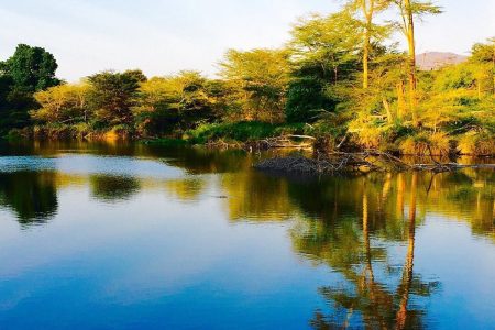
The Tana River is the county’s defining feature. Flowing from the highlands of central Kenya to the Indian Ocean, it creates fertile floodplains and delta ecosystems in its lower reaches. Seasonal flooding shapes agriculture, grazing patterns and settlement.

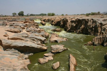
The landscape includes riverine forest, woodland, open grassland and semi-arid scrub. Notable natural features include the Bilbil Hills, the Lagas seasonal river system, sand dunes and inselbergs. Grand Falls, located upstream near the border with other counties, is one of Kenya’s largest waterfalls by volume during peak flow.

Near the coast, the Tana River Delta supports mangroves and wetland systems that are ecologically significant for birdlife and fish breeding.

Wildlife and Protected Areas

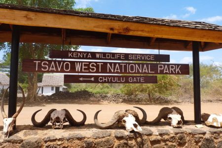
Tana River County contains several protected areas, though these are remote and lightly developed compared to Kenya’s major safari destinations.

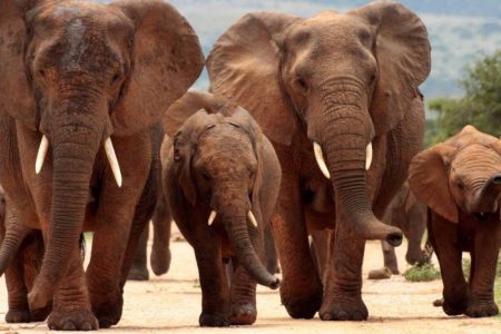
Kora National Park lies in the western part of the county and is known for its rugged terrain and historical association with conservationist George Adamson, whose grave remains within the park. Wildlife includes elephants, lions and various antelope species, though sightings require patience and local guidance.

Tana River Primate National Reserve was established to protect the endangered Tana River red colobus and mangabey monkeys. The reserve consists largely of riverine forest fragments and is of particular interest to researchers and conservation-focused visitors.

Arawale National Reserve, in the northern region, was once an important sanctuary for the rare hirola antelope. The reserve remains ecologically significant, though infrastructure is limited.

Travel to these areas requires planning, appropriate vehicles and local coordination.

Communities and Livelihoods

The county is home to several communities, including the Pokomo, Orma and Wardei peoples. The Pokomo traditionally practice riverine farming along the Tana floodplains, while the Orma and Wardei communities have pastoralist traditions.

Agriculture and livestock rearing remain the primary economic activities. Fishing also plays a role in communities closer to the delta.

Religion in the county includes both Christianity and Islam, with Islamic influence stronger in areas closer to Lamu and the coast.

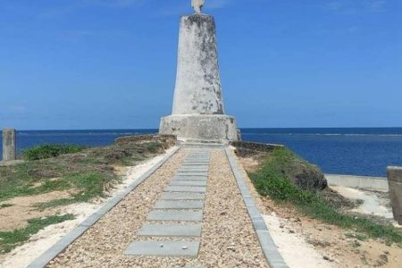
Kipini and the Coastal Edge

At the southeastern boundary of the county lies Kipini, where the Tana River meets the Indian Ocean. This area combines riverine forest, mangroves and coastal scenery. Tourism here is small-scale and lodge-based, appealing to travellers interested in fishing, birdwatching and quiet river settings rather than beach resorts.

Climate

Tana River County lies within a semi-arid climatic zone. Annual rainfall is generally below 600 mm in many parts of the county, with higher precipitation occurring along river corridors. The area experiences two rainy seasons, typically from April to June and again in October and November.

Temperatures are warm to hot throughout the year, often exceeding 30°C during the day. Travel conditions are generally easier during the drier months when road access improves.

Access

By road, Tana River County can be reached from Nairobi via Thika and Mwingi toward Hola, or through the coastal highway network connecting to Kilifi and Lamu regions. Road conditions vary and may be affected by heavy rains.

Hola Airport serves as a small civilian airstrip with limited scheduled services.

Independent travel into remote areas is not advised without local knowledge or coordination.

Accommodation and Experiences

Accommodation options in Tana River County are limited and typically lodge-based, particularly near Kipini and along parts of the river and delta. Experiences may include wildlife viewing in Kora National Park, birdwatching in the delta, fishing excursions and conservation-focused travel.

This destination is best suited to eco-tourists, researchers, birdwatchers and experienced domestic travellers seeking remote landscapes rather than resort-style amenities.

San Francisco

Stories, tips, and guides

Vasco da Gama Pillar

The Vasco da Gama Pillar, located on the shores of the Indian Ocean in Malindi, Kilifi County, is a historical marvel that has been attracting tourists for over six centuries. Erected in 1498 by the renowned Portuguese explorer, Vasco Da Gama, the pillar stands as a testament to his pioneering journey from Europe to India via Africa’s Cape of Good Hope. On two momentous voyages between 1497 and 1502, Vasco da Gama not only landed and traded with locals along the southern African coast but also reached the shores of India on May 20, 1498. Historical accounts suggest that Vasco da Gama constructed the pillar to aid his fellow sailors in finding their bearings towards India and also played a crucial role in promoting trade between India and Portugal. Serving as one of the oldest European cenotaphs on the East African coast, the Vasco da Gama Pillar once provided direction to those navigating the sea route to India. This pillar, resembling a lighthouse without lights, is believed to have been visible to Portuguese explorers as they approached Malindi’s shores from the vast sea. Adjacent to the pillar stands the Portuguese Chapel which served as a place of prayer and became the final resting place for those who passed away during their voyages. Having stood the test of time, the Vasco da Gama Pillar witnessed Malindi’s history evolve, including the British colonialists’ occupation under the British East Africa protectorate. Vasco Da Gama’s arrival in Malindi in 1498 was greeted warmly by the Sultan of Malindi, marking the beginning of connections between Europe, Africa, and the Middle East, particularly India. In the 15th Century, Portugal’s spirit of exploration spanned across the globe. King Dom Manuel of Portugal appointed Vasco da Gama in 1497 to lead a fleet of four ships on a voyage to India through the Far East. After numerous adventures, the fleet anchored off Malindi on Easter Sunday, April 15th, 1498, where they were heartily welcomed by the Sultan. In response to Vasco da Gama’s request, the Sultan provided a skilled sea captain, Ibn Majid, who guided the fleet across the vast Indian Ocean to Calicut, India. Vasco da Gama’s favorable reception during his first visit likely led him to return to Malindi during his voyage back in 1499. On this occasion, his sailors were permitted to erect a pillar topped with a cross bearing Portugal’s Coat of Arms. Unfortunately, the presence of this Christian symbol caused dissatisfaction among the Muslim community, leading to its removal. However, representation from the small Portuguese community, which had established a trading post in Malindi, eventually persuaded the Sultan to permit the construction of a pillar at its current location to hold the cross. This pillar, known as the original Padrao, is the sole remaining one out of several placed along the African coastline by various Portuguese seafarers. Over time, the exposed location of the pillar led to weathering and erosion. In 1973, Captain Malcom of HMS Briton arranged for the protective concrete cone to be built, concealing the original pillar while supporting the limestone cross. This limestone was confirmed to be from Portugal upon examination. Declared a gazette National Monument in 1935, the Vasco da Gama Pillar now falls under the watchful care of the National Museums of Kenya. NMK has undertaken various restoration efforts, including reinforcing the sea wall, paving the access road, and providing amenities like parapet walkways, an ablution block, and a pavement to ensure an enhanced tourist experience, including easy access for people with disabilities. Operating Hours The Vasco da Gama Pillar is open daily from 6 am to 6 pm. Admission Fee to the Vasco da Gama Pillar To explore this remarkable historical landmark and gain access to four national monuments, including the Portuguese Chapel, House of Columns, and Malindi Museum, guests can acquire a single ticket at the following prices:

Rabai Church Museum

Rabai Church Museum The Rabai Church Museum, situated in Kaloleni, approximately 25 kilometers northwest of Mombasa and just a short half-hour drive from the city, holds great historical significance in the context of Christianity and European education in Kenya, with a history dating back over 150 years. Initially built in 1846, it stands as the first church structure in the country and continues to be an important historical monument in East and Central Africa. Adjacent to the church is the Krapf Memorial Museum, established in 1994 to commemorate the early missionary events.The Rabai Museum is housed within the original church building, which retains its rustic charm from the 19th century. Johann Ludwig Krapf, a pioneering German missionary and explorer in East Africa, constructed this medieval religious architecture. Inside the museum, visitors can explore religious and cultural artefacts and records depicting the challenging campaign to spread Christianity despite local resistance and animosity. Johann Ludwig Krapf and Johannes Rebmann played pivotal roles in establishing the church, making their work a focal point of the museum. As one of Kenya’s earliest churches, it serves as a tangible reminder of the initial involvement of European missionaries in the country and the broader East Africa region. The Rabai Museum offers a diverse range of collections that shed light on the history of Christianity and the Slave Trade. Additionally, it features cultural artefacts belonging to the Mijikenda people. Visitors can admire regalia and traditional clothing, such as the hando (a short skirt) and kishutu (coloured fabric), as well as tools used in the preparation of traditional food. These exhibits provide a fascinating glimpse into the region’s rich cultural heritage. Rabai Museum Entry Fees: Citizens of Kenya: Residents of East Africa: Non-Residents: Opening Hours: Rabai Church Museum Contacts Location: Rabai Church Museum, North-west of Mombasa, off the Nairobi-Mombasa highway. Kilifi County, Kenya. Phone: 020 3742741

Tsavo East National Park

Explore acacia savannahs where dust‑red elephants and maneless lions roam free

Holy Ghost Cathedral Catholic Church

Mombasa Holy Ghost Cathedral Catholic Church Situated at the heart of Mombasa’s Central Business District, the Holy Ghost Cathedral Catholic Church stands as a testament to the city’s rich history and architectural splendour. Established in 1889 by Father Alexander le Roy, a Holy Ghost missionary, it is Mombasa’s first Catholic mission.The cathedral, built in the imposing Romanesque style, was opened to the faithful in 1923 after eight years of construction that commenced in 1916, during the tumultuous period of the First World War and the devastating Spanish flu pandemic. Despite these challenges, the church’s construction persevered, showcasing the dedication and resilience of the Catholic community in Mombasa. The roots of the Holy Ghost Cathedral Catholic Church trace back to the arrival of the Congregation of the Holy Spirit, known as the Spiritans, in Mombasa in 1889. Under the guidance of Monseigneur Raoul de Courmont, who was appointed the Vicar Apostolic of Zanzibar, Father Le Roy was sent on an exploratory mission to Mombasa. Father Le Roy, considered the pioneer of the church in Mombasa, settled in the city and established the first chapel in Ndia Kuu, Old Town. The church primarily catered to Goan and European communities in its early years.The church’s growth necessitated a move from the cramped chapel to a larger space. In 1898, a five-acre plot in the Makadara area was acquired to construct a new church capable of accommodating around 400 people. However, as the population continued to surge, the demand for a more substantial church became apparent by 1900.The task of designing the new church fell upon Walter Gustav, a proficient builder and missionary brother from the Spiritans. His plan, accepted by Bishop John Neville, received enthusiastic support from the congregation, who pledged funds for its realization. Despite the challenges posed by World War I, Brother Gustav, along with Brothers Killian Retig and Claver Fernandes, laid the foundation stone in 1916. During the church’s construction, residents were trained in stone carving and sculpting to utilize the readily available coral stones. Even the Spanish flu pandemic outbreak in 1918 did not deter their efforts to complete the project. Finally, in 1923, the Holy Ghost Cathedral Catholic Church, with its distinctive Romanesque architecture and prominent towers visible from the sea, stood as a testament to the unwavering dedication of the community.The interior of the cathedral is equally captivating. The high altar, tabernacle, and ambo were crafted from exquisite marble, skillfully carved and sculpted by stonemasons in Toulouse, France. The church boasts an array of coloured stained glass windows, each depicting significant aspects of the Catholic faith. Behind the tabernacle, three windows narrate the story of the church, with the central one dedicated to the Holy Spirit, the right one symbolizing the baptism of Christ, and the left representing the descent of the Holy Spirit, which marked the church’s inception. The church’s ceiling is an intricate replica of London’s Westminster Cathedral. Painstakingly hand-painted by an artist lying on a precarious platform, each cell was meticulously adorned, showcasing the remarkable craftsmanship involved.In 1923, following the consecration of the present cathedral, the original church from 1898 was transformed into a bookshop and printing press. It played a vital role in disseminating monthly publications such as “Rafiki Yetu” and “Catholic Times of East Africa.” Regrettably, this historic church building was eventually demolished in the 1970s to make way for Ambalal House.Today, the Holy Ghost Cathedral Catholic Church is a significant attraction and historic site in Mombasa, drawing visitors from far and wide to admire its grandeur and explore its rich heritage. It serves as a place of worship, a symbol of faith, and a window into the history of Catholicism in the region.

Mzima Springs: A Wildlife Haven

Discover the Geological Marvel and Abundant Wildlife of Mzima Springs Mzima Springs, located within the breathtaking Tsavo National Park in Taita-taveta County, Kenya, has captivated visitors with its stunning beauty and fascinating geological formation. These series of four springs owe their existence to a combination of rainfall, underground rivers, and porous volcanic rocks. Renowned for its crystal-clear waters and vibrant wildlife, Mzima Springs has become an iconic attraction in the region. The story of Mzima Springs begins in the Chyulu Hills, a volcanic mountain range adjacent to the springs. Thanks to substantial rainfall, the porous volcanic rocks of the hills serve as a natural reservoir. Rainwater seeps into these rocks, gradually creating a vast network of underground rivers. These rivers converge and flow towards the lower-lying areas, including Mzima Springs. The volcanic rocks’ porous nature allows the water to filter through, accumulating in underground reservoirs over time. The Clarity of Mzima Spring’s Waters Mzima Springs, originating from the Chyulu Hills, is a remarkable water source producing an astonishing 250 million liters of fresh water daily, playing a vital role in supplying Mombasa. As the water emerges from the underground reservoirs, it forms four main springs that collectively feed a series of pools and lush vegetation. The exceptional clarity of the water at Mzima Springs is a result of its filtration through the porous volcanic rocks. This natural filtration process effectively removes impurities, resulting in remarkably clear and transparent waters. Visitors can peer into the depths of the springs, where they will be captivated by the thriving aquatic life below. Additionally, Mzima Springs offers a unique feature—a specially designed underground tank with perspex sides. This tank allows visitors to view numerous fish at eye-level, both below and above the waterline, providing an even more immersive experience. Wildlife Haven Mzima Springs is famous for its resident populations of hippos and Nile crocodiles, making it a true haven for wildlife within Tsavo National Park. These magnificent creatures can be observed in their natural habitat, offering an awe-inspiring spectacle. Wildlife film-makers Alan and Joan Root immortalized Mzima Springs in their nature documentary “Mzima: Portrait of a Spring” (1969), featuring remarkable underwater footage of the hippos and crocodiles. The springs were also the subject of the Survival Special “Mzima: Haunt of the Riverhorse” (2003), which revealed the first-ever recorded footage of hippo infanticide. Nature Trails and Scenic Splendor Exploring Mzima Springs is an adventure that allows visitors to immerse themselves in the park’s breathtaking landscapes. Well-maintained nature trails wind along the shoreline, offering glimpses of the abundant wildlife and panoramic views.  The main trail stretches approximately 1 kilometer and can be comfortably walked in about 20 minutes. Along the way, lush vegetation, towering trees, and a rich variety of bird species add to the enchantment of the surroundings. Mzima Springs’ trails provide a serene escape where visitors can reconnect with nature and appreciate the wonders of the park. Education and Conservation Mzima Springs also serves as an educational hub, offering programs by the Kenya Wildlife Service that highlight the water cycle and the importance of water conservation. Visitors have the opportunity to deepen their understanding of the delicate balance of ecosystems and the significance of preserving these natural resources for future generations.  Preserving a Natural Treasure The existence of Mzima Springs depends not only on the geology of the region but also on maintaining a delicate balance between rainfall and the replenishment of underground water sources. As a vital water source for diverse wildlife and local communities, the management and conservation of these springs are crucial. 

Tsavo West National Park

Explore Mzima Springs, lava fields and Kenya’s iconic red elephants.

Discovering Lugard Falls

Lugard Falls, situated in the central region of Tsavo National Park within Taita-Taveta County, is a captivating natural marvel renowned for its abundant historical significance. Its name pays homage to Frederick Lugard, a distinguished British explorer and colonial administrator. Geographic formation Lugard Falls is formed by the Galana River as it encounters a series of geological features in its course. The river’s rapid flow leads to a plunge into a large pool, creating a mesmerizing display of natural power. The surrounding landscape, shaped by the relentless force of the river, has resulted in a narrow rocky gorge through which the water flows, culminating in the breathtaking cascade of Lugard Falls. The falls are known for their impressive white water rapids, caused by rocks obstructing the Galana River’s path. The water plunges into a large pool, offering a captivating spectacle.  One of the distinctive features of Lugard Falls is the presence of multicolored rocks. These rocks, exhibiting beautiful strips of pink, light grey, and white, add to the unique appeal of the falls. The constant flow of water has shaped and carved these rocks, contributing to the visually stunning landscape. Opening Hours: Lugard Falls is open for visitation from 9:00 am to 6:00 pm every day. Best Time to Visit: The falls can be visited throughout the year, regardless of the season. However, the rainy season, which typically occurs from March to May and October to December, offers a more powerful, and visually striking experience as the water flow intensifies. What to Wear: To make the most of your visit to Lugard Falls, it is recommended to wear comfortable clothing and sturdy walking shoes. Additionally, bring a hat, sunglasses, sunscreen, and insect repellent to protect yourself from the sun and potential insects in the area. Additional Information: Crocodile Point: Located about a kilometer below the falls, Crocodile Point is a habitat for giant crocodiles and hippos. It’s an interesting spot to observe these fascinating creatures. Safety Precautions: While exploring Lugard Falls, always adhere to safety guidelines. Stay a safe distance from the falls and follow instructions from park rangers to ensure a secure and enjoyable visit. Activities to be enjoyed at Lugard Falls Hiking Here the starting point is from Lugard and Harlech Road, you can walk either way and later you will end up back at the same time spot, following the clockwise there is a great view of the Peak Tower as you finish your hike this takes you around 40 minutes. There are several hiking trails around the peak but this is a very easy option that is a gentle walking path rather than a hike. It is a flat and pave the whole way even small children with little legs can manage it easily, you pass many people on the way and it is a popular running spot for locals. The path takes you through typical jungle-like Hong Kong growth, Banyan tree root system, tentacle-like. Lugard Falls is also a nice point of interest and if there has been recent rain it will be full flow, cascading down the mountain Guided Tours For a more enriching experience, guided tours are available at Lugard Falls. Knowledgeable park rangers can accompany visitors and provide valuable insights about the falls, the surrounding ecosystem, and the diverse wildlife species in the area.  Wildlife safaris There are various animal species in Lugard Falls and including the cheetah, zebras, hippos, wildebeest, giraffes, wild dogs, hyenas, and many others and the Lugar Falls also acts as a good sighting area for those animals during your visit to the Tsavo East National park. Birds Safaris In Lugard Falls you also be able to view or observe the unique variety of bird species such as crowned crane, black kite, lovebird, sacred ibis, and many more, here you can observe the bird species since the falls are on a flat land with dry plains a cross in the Tsavo East national park. Nature walking safaris Nature walking offers an incredible wildlife experience, this safari is done on foot and the visitors around led by the ranger guides for protection from animal attacks for example like from the crocodiles in Lugard Falls, the tourists or visitors enjoy the beautiful nature of the Lugard falls that is by viewing the power of the waterfall disappearing in deep chasms in its boundaries, you can be able to see hippos and crocodiles below the fall. Camping If you’re seeking an immersive outdoor experience, camping is an option within and around Lugard Falls. Galessa Camp, located a short distance upstream from the falls, offers a picturesque camping site. The camp is open year-round, allowing visitors to enjoy the beauty of the area regardless of the season.  The climate The climate in this region is generally hot and dry, with refreshing cooling breezes that can be attributed to the nearby Lugard Falls. Camping amidst the natural splendour of Lugard Falls provides a unique opportunity to connect with nature and fully immerse yourself in the tranquil ambiance of the surroundings.

Mama Ngina Waterfront Park

Enjoy a palm lined waterfront stroll with cool sea breeze and Kilindini Channel views.

Get special offers, and more from Traveler

Subscribe to see secret deals prices drop the moment you sign up!

[mc4wp_form id="92"]
error: Content is protected !!